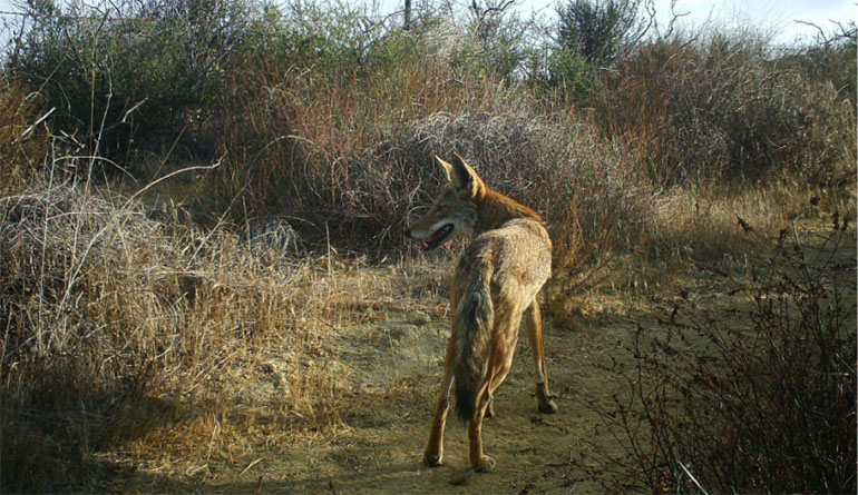
Irvine Ranch Conservancy (IRC), along with landowners OC Parks, City of Irvine, and City of Newport Beach, are dedicated to their mission of preserving Orange County’s urban wildlands through a variety of science-based programs. IRC’s Monitoring and Research program is a key component of this work, allowing the organization to track changes in the vulnerable ecosystems of Orange County to make informed management decisions.
Since 2007, IRC has been using a network of strategically placed heat- and motion-triggered remote cameras throughout the Irvine Ranch Natural Landmarks to monitor the health and activity of wildlife. Images captured on these cameras provide data and information that can help IRC identify and understand threats that could negatively impact the overall health of the landscape. However, this project has always been limited by technology and the time it takes to process the thousands of images captured on the camera traps. To improve their ability to collect and process data, IRC staff have installed new camera equipment and implemented the use of new artificial intelligence (AI) software.
“The wildlife monitoring cameras are an extremely useful tool for assessing the health of native habitats and wildlife,” said Catherine Le, IRC Monitoring and Research Program Coordinator. “We were looking into how we could reduce the photo-processing time and made the decision to upgrade our camera equipment, which would lead to better data collection.”
The new wildlife monitoring cameras have increased storage capacity, improved image quality, and a wider focal range, so more can be seen in a single image. This means an increased probability of capturing wildlife on each camera, but the challenge of reviewing hundreds of thousands of these images remained. In the past, this was done by visually reviewing every image, despite many of them often only containing vegetation blowing in the wind.
IRC teamed up with Microsoft to combat this problem. Microsoft’s AI and machine learning software, MegaDetector, can be applied to detect wildlife in the images so that less time is spent sifting through “false trigger” photos. The software is trained with local camera trap data to recognize when either an animal, vehicle, or human passes through and then automatically tag these photos. To access the increased computing power necessary to run this program, IRC was awarded an AI for Earth grant from Microsoft.
“By collaborating with Microsoft and employing AI software, we dramatically increased the efficiency with which we process the camera trap data,” said Rachel Kenny, IRC Project Manager. “This allows our team the capacity to ask more in-depth questions about wildlife dynamics in relation to factors such as our restoration efforts and increasing fire frequency, which in turn will inform land management decisions and improve our understanding of our wildlife communities and their habitats.”
As more new technologies become available, IRC hopes to explore camera technology that can capture a larger range of smaller animals, as well. “Traditional wildlife monitoring cameras are generally set up to capture larger animals like mountain lions and bobcats,” said Kenny. “Smaller animals such as rodents and snakes don’t have as prominent of a heat signature nor do they create as much motion to activate the camera, so they are harder to capture. We are developing pilot programs and testing new technology and experimental designs that will help us capture data on a wider range of animals, not just the charismatic megafauna.”
For more information about the Irvine Ranch Conservancy and wildlife monitoring on the Landmarks, visit IRConservancy.org.
